Khakhuli Monastery (Tao of Region)

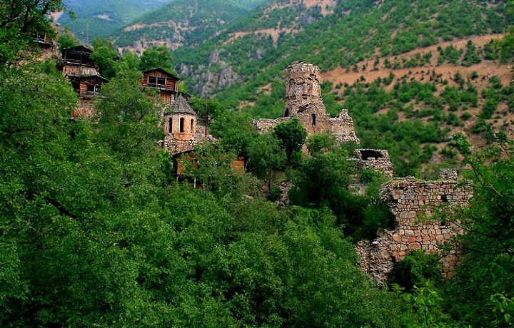
Khakhuli Monastery (Geor. ხახულის მონასტერი, Tur. Hahuli Manastiri) is located in the historical region of Georgia-Tao (Geor. ტაო), in the Tortomi (Geor. თორთომი) area of Erzerum (Geor. კარნუ-ქალაქი) province, not far from the village of Khakhuli (Geor . ხახული), modern Bagbashi (Tur. Bağbaşı), on the left bank of the Khakhulistskali River (Geor. ხახულისწყალი). The Khakhuli Monastery was founded in the second half of the 10th century and was a large ensemble of several buildings. To date, the main temple of the Virgin, a separate hall church (IX century), the remains of a three-aisled basilica and a fence gate have been preserved. The complex is surrounded by a low stone wall. There was an academy at the monastery, the pupils of which were many famous Georgian scientists and theologians. An outstanding triptych of the 12th century, the Khakhuli Icon of the Mother of God (Geor. ხახულის ღვთისმშობლის ხატი), created in Khakhuli Monastery, is one of the best examples of Georgian medieval jewelry art.

The main, large domed temple of the monastery is a cruciform, elongated building, reflecting the early cross-domed style of architecture. The inner walls of the temple, as well as the facades, are lined with hewn stone. Georgian inscriptions (Asomatruli) (Geor. ასომთავრული) have survived on the walls of the Khakhuli temple, indicating the names of the masters who built the temple. The images of St. George and the Mother of God are clearly visible on the doors of the cathedral. After the arrival of the Turks and the expulsion of the indigenous population, the temple turned into a mosque and this saved it from natural destruction. Several saints of the Georgian Orthodox Church are buried on the territory of the monastery, but the location of their graves has been lost. Now near the temple you can see Muslim tombstones, very old, judging by their condition. One of the small churches in the courtyard of the monastery, which has survived to this day, is today used as a woodshed of the mosque.

Khandzta(Khantsta) monastery (Region of Klarjeti)

Khandzta or Khantsta monastery (Georg. ხანძთის (ხანცთის) მონასტერი, Tur. Handzta Manastırı) – The monastery complex  in the historical region of Georgia – Clarjeti (Georg. კლარჯეთი). It is located in the historical Georgian village of Khandzta (Georg. ხანძთა), modern  Pirnalli (Tur.  Pırnallı), in the province of Artvin (Georg. ართვინი), Turkey. Founded at the end of the 8th century by a saint – Grigol Khandzteli (Georg. გრიგოლ ხანძთელი). The monastery complex took its final form in 918-941. To the west of the main church, there is a well-preserved two-story building of the bell tower, in the inscriptions of which the name of the builder of the bell tower is mentioned – Markozi (Geor. მარკოზი). Behind the protective wall of the monastery there is an architecturally decorated spring. A small hall chapel was built on it.

The main temple of the monastery, the Church of Khandzta of the Holy Great Martyr George, due to its graceful size and high proportions, dominates not only the monastery complex, but also the entire adjacent territory (Georgian architect – Amona (Georg. ამონა, surname unknown). It is safe to say that Khandzta Church is a representative of a new stage of medieval Georgian architecture. The building stone of the temple is carefully processed. They are so tightly fitted to each other that lime mortar is not visible between the stones. For facing the dome, a particularly high-quality stone was used, which was bought and worn from a long distance on the backs. Obviously, in order to destroy the main temple, the supporting pillars of the dome were deliberately removed. However, the almost hanging dome still maintains its stability, thanks to the highest technical quality of the construction and the use of a strong connecting solution. Currently, most of the walls of the church have been demolished and this magnificent architectural and historical monument is on the verge of destruction.

Fortress of Kinzodamali (Region of Erousheti)

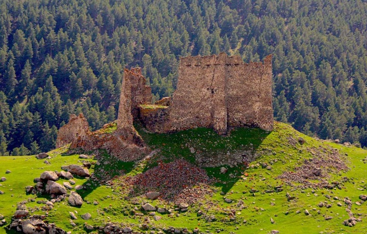
Fortress of Kinzodamali (Georg. ქინძოდამალის ციხე, Tur. Kinzodamal(Kinzi) kalesi) – located in the historical region of Georgia – Erusheti (Georg. ერუშეთი), west of the historical village of Kinzodamali, now Bagdeshan (Tur. Bağdeşan), at an altitude of 2200 meters, on Mount Arsiani (Georg. არსიანი), today Bilbilan (Tour. Bilbilan). Mount Arsiani (Bilbilan) was the border between the historical regions of Georgia – Erusheti, Klarjeti (Georg. კლარჯეთი) and Shavsheti (Georg. შავშეთი). Roads of strategic importance passed here, connecting the above-mentioned historical regions of Georgia, and it was to control these roads that the ancient inhabitants of this place built the Kinzodamali fortress.

The castle is very damaged. Its plan is determined by the configuration of the hill. The northern part of the protective wall is quite thick (1.50 m), which is relatively well preserved and has survived to this day. The maximum height of the tower located in the eastern part of the castle is 16-17 m, in the north-western part – 12-13 m. Along the eastern part of the fortress, along the entire length, an additional protective wall is being built, 3-5 meters away from the main wall. According to the ceramic material found on the territory of the castle, scientists suggest that the complex is a monument of the developed Middle Ages.

Klarjeti Fortress (Region of Klarjeti )

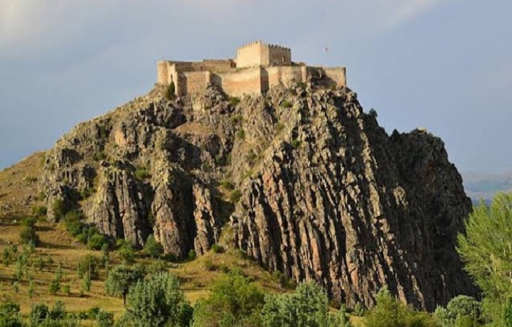
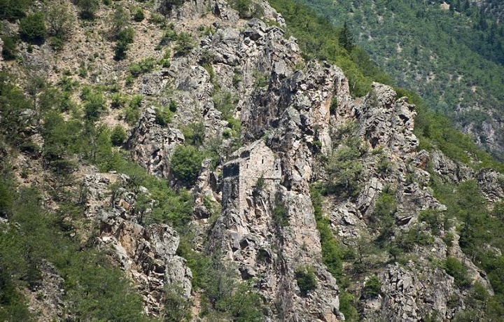
Klarjeti Fortress (Georg. კლარჯეთის ციხე,  Tur. Klarceti Kalesi), ancient castle in the village of Klarjeti, now Bereket (Tur. Bereket), in the province of Artvin, in the southwestern part of historical Georgia – Klarjeti (Georg. კლარჯეთი). It is believed that the castle with two towers had an important function in the medieval region of Klarjeti. One tower has survived to this day. A water tank was found in the ruins of the second tower. The surviving remains of today’s fortress date back to the Middle Ages. There is an opinion that on the site of the current castle there was another, older castle.

Clarjeti fortress is located on a rocky hill, at an altitude of 1440 m. The walls rise, as if being a continuation of a sheer cliff. The powerful fortress was built of roughly hewn stones and stretched for many meters along the coastline of the cliff. Above the small gate, on the southern facade of the castle, there is an arch in the form of an arrow. There is another gate on the north side. To the southwest of the castle was a church, which is completely destroyed. Faceted pink stones from this church were used in the construction of the mosque. On the southern wall of the mosque there is a Georgian inscription in the letters “Asomtavruli”(Georg. ასომთავრული).

Fortress of Kvelistsikhe (Region of Erusheti)

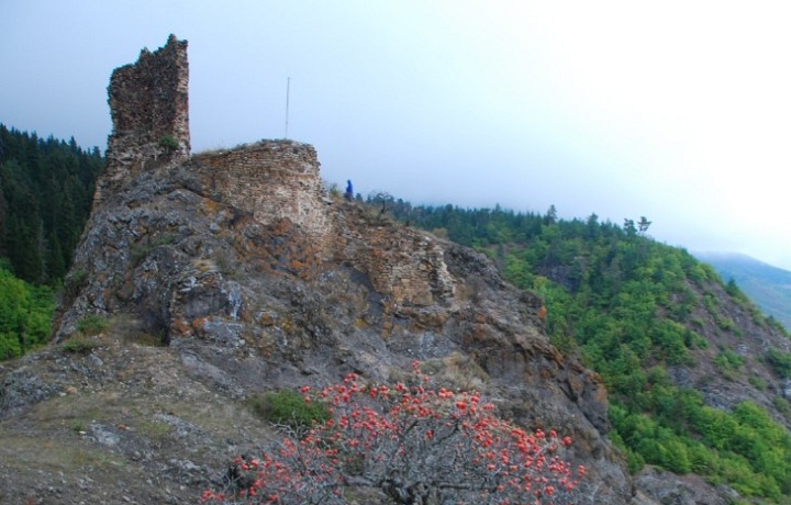
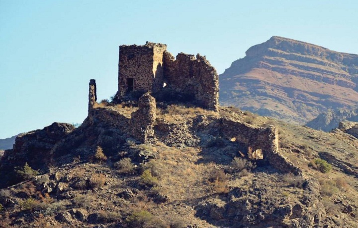
Fortress of Kvelistsikhe (Georg. ყველისციხე(ყუელისციხე), Tur. Kuvel(Kol) Kalesi) – medieval Georgian fortree in the historical region of Erusheti (Georg. ერუშეთი), located in the village of Kolka (Tyr. Kolköy), on top of the Arsiani Mountains (Georg. არსიანის მთა), territory of modern Turkey. The castle, which first appeared in Georgian sources at the beginning of the 10th century, is now almost completely destroyed. The castle is located on a hill, directly above the Tsurtskabistskali (Georg. წურწყაბისწყალი) river. Round tower 10 meters high, one of the remaining towers of the fortress wall, which can be seen today. There is a small cruciform church in the eastern corner of the castle. Fragments of clay and ceramic products were found on the territory of the castle.

Due to its strategic position, Kvelistsikhe fortress has seen many military conflicts, wars and sieges throughout its history. It was located at a strategically important crossroads and controlled trade routes connecting different regions and countries. After the formation of the Bagration principalities in Tao-Klarjeti in the 9th-10th centuries, Kvelistsikhe became a regional center and one of the most important fortresses of Samtskhe. Throughout its history, the fortress served as the epicenter of a number of military conflicts. In the 16th century, the fortress, like most of southwestern Georgia, fell under the rule of the Ottomans and lost its former significance.

Fortress of Mere (Region of Samtskhe)

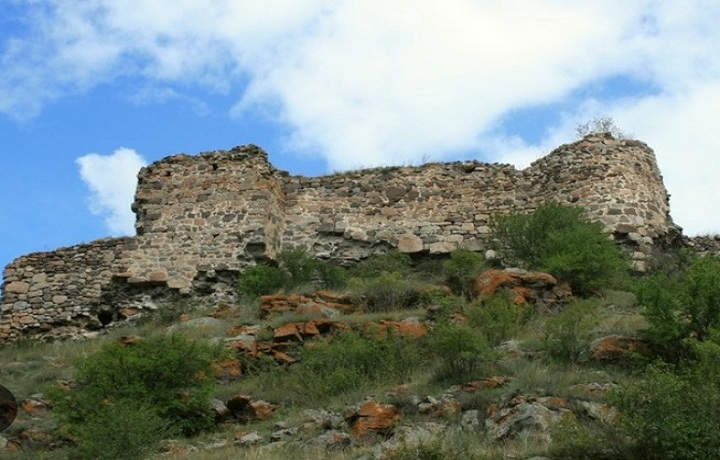
Fortress of Mere (Georg. მერეს ციხე, Tur. Mere kalesi) is located in the historical region of Georgia – Samtskhe (Georg. სამცხე), not far from the historical village of Mere (Georg. მერე), now Chakyrkoch (Tur. Çakırkoç), in the  Posof district of modern Turkey. The fortification built on the right bank of the Potskhovistskali (Georg. ფოცხოვოსწყალი) received its name from the nearest village of Mere, located on the plain of the Potskhovistskali River. Mere Fortress was one of the most important fortifications in the area and served as a border fortress of the historical region.

The fortress is located on a rocky hill and the building plan of the castle is adapted to the topography of the mountain on which it is built. Today, only three large parts of the castle remain, which are largely destroyed. Several building layers can be seen in the walls. On the right side of the entrance, on a stone boulder built into the southwestern wall of the castle, a Georgian inscription is carved. To the southeast of Mere Castle, on a slope outside the walls, there is a dilapidated church. The church, which is a single-nave building, was built in the 10th century according to its design features. According to historians, the church is a small remnant of a previously existing monastery complex.

Fortress of Mgeltsikhe (Region of Tao-Klarjeti)

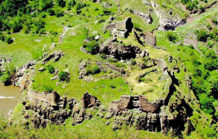
Fortress of Mgeltsikhe (Georg. მგელციხე, Tur. kurtkale) – The medieval fortress in the historical region of Georgia-Tao-Klarjeti (Georg. ტაო-კლარჯეთი), near the historical village of Kartanakhevi (Georg. ქართანახევი), now akiraz (Tur. Akkiraz). The fortress controlled the leading road from the south to Georgia. From the once impregnable fortress, the ruins of walls, towers, churches and residential premises have been preserved. It is surrounded on three sides by the hard-to-reach rocky valley of the river of Mtkvari (Georg. მტკვარი). The northern side of the castle, relatively poorly protected by nature, is carefully fortified with a high wall.

The medieval castle of a round shape is located on several terraces carved into a rocky hill. Judging by the style of construction, it must have been built in the 9th-10th centuries. Two towers are built into the protective wall of the castle, which are badly damaged. The main tower of the castle and the hall-type church are located on the uppermost terrace. In the southwestern part of the castle, a secret tunnel was cut through the rock leading to the Mtkvari River. The building, apparently, has traces of reconstruction work, after being destroyed in different periods. In the most ancient, initial layers of construction, relatively well-worked stones of medium size are used.

Nikhakhi Fortress (Region of Tao)

Nikhahi Fortress (Georg.  ნიხახის ციხე, Tur. Nihahi Kalesi) – medieval fortress in the historical region of Georgia – Tao (Georg. ტაო), near the historical Georgian village – Nikhahi (Georg. ნიხახი), now Yokuslu (Tour. Yokuşlu). The fortress was built on the right bank of the Chorokhi River (Georg. ჭოროხი), on a rocky hill, about 900 meters above sea level. The plan of the fortress is determined by the relief of this rock. The fortress was an important fortification and from the very beginning performed an important defensive function. It provided protection for the road connecting the historical regions of Georgia – Speri (Georg. სპერი) and Tao.

Nikhakhi Fortress was built in an easily accessible place, at the crossroads of important trade routes. Due to its easily accessible location, the fortress was especially well fortified with walls and could withstand many days of siege. The main fortification of the castle, a quadrangular and multi-storey tower, was built in its eastern part. In the eastern part, the ruins of the once mighty cylindrical tower have also been preserved. The main gate, located in the south, has defensive towers on both sides. The protective wall with loopholes, which at one time surrounded the castle along the entire perimeter, was completely destroyed. The inner territory of the castle was excavated by Turkish gold diggers.

Church of Nuka (Region of  Klarjeti)

Church (Sakdari) of Nuka  (Georg. ნუკას საყდარი, Tur. Nukas saqdari kilisesi) – located in the historical region of Georgia – Klarjeti (Georg. კლარჯეთი), in the modern Turkish province of Artvin (Georg. ართვინი) , on the right bank of the river Karchkhali (Georg. კარჩხალი). The church is a two-nave basilica built on a high steep rock. Built from roughly cut local rock, it blends in with the environment in a special way. On the north side, the church adjoins a rocky slope and a part is carved into it.

The construction technique bears the characteristic features of churches of the 9th century, but, according to scientists, this is an earlier building and, most likely, was one of the most ancient temples of the Fhorti eparchy, which existed in the 6th-7th centuries. According to the same opinion, the church is a small remnant of a large monastic complex that existed earlier. Other buildings have survived to the southeast of the basilica. The entrance door with an arched roof is located in the wall of the fence. A tower-like structure and several niches are also built into the wall.

Opiza Monastery (Region Of  Klardjeti)

Opiza Monastery (Georg. ოპიზას მონასტერი, Tur. Opiza Manastırı). The Georgian monastery complex Opiza is located in the historical region of Klarjeti (Georg. კლარჯეთი), in the modern province of Artvin  (Georg. ართვინი), not far from the historic Georgian village of Opiza  (Georg. ოპიზა) , today Bagchilar (Tur. Bağçılar). The monastery was founded in the second half of the 5th century and has been an important religious and cultural center for centuries. In the 12th century, famous jewelers Beka and Beshken Opizarb worked in Opiza.

Opiza Monastery was built in the valley of the Shavsheti (Georg. შავშეთი) and Imerkhevi (Georg. იმერხევი) rivers, on a steep slope, on large terraces. To the southwest of the temple is a bell tower, of which only the lower floor has survived. The ruins of the refectory of the 11th century have survived to this day. After the conquest of Klarjeti by the Ottomans in the 16th century, Opiza was completely deserted. The walled complex was well preserved until the 20th century, including temple paintings and stone carvings. In 1965, during the construction of a road in the village, the church was blown up, after which the complex was almost completely destroyed.