Oshki Monastery (Region of Tao)

Oshki Monastery (Georg. ოშკის მონასტერი, Tur. Oşkvank Manastırı) –  Georgian monastery complex located on the historical territory – Tao (Georg. ტაო), surprising visitors with its grandeur, was built in 963-973. Oshki was an ancient Georgian cultural and educational center. The manuscripts created in the monastery have come down to us, among which the Bible of Oshki (Georg. ოშკის ბიბლია) (978), which is a complete translation of the Bible into Georgian, is of particular importance. Currently stored on Mount Athos.

The domed temple forms the shape of a cross and of a tetraconch. Dedicated to St. John the Baptist and is one of the largest cross-domed churches in the region. To the northeast of the cathedral are the ruins of a library, a seminary, a refectory and utility rooms. In terms of inscriptions, the Oshki temple is one of the richest Georgian temples. The abundance of arches is striking, there are many Bas-reliefs on all four facades of the temple. They clearly stand out from a flat surface. In recent years, the temple has been looted several times. Wonderful frescoes and tiles with Georgian inscriptions have disappeared from the walls.

Otkhta Monastery Complex (Region of Klarjeti)

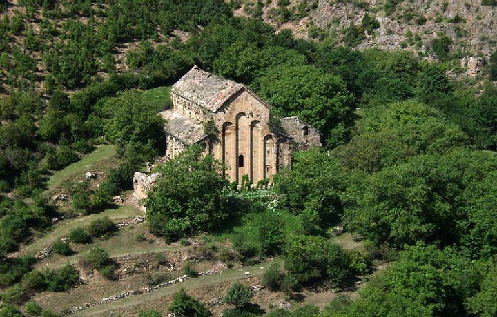
The monastery complex (four) (Geor. ოთხთას სამონასტრო კომპლექსი, Tur. Dört kilise manastıri) is located in the Geogian historical region – Klarjeti (Georg. კლარჯეთი), in the province of Artvin (Georg. ართვინი) of modern Turkey. The monastery complex, in fact, consisted of four churches. The ruins of one of them have been preserved in the center of  modern village – Tekkale (Tur. Tekkale). The remains of other churches, including the main cathedral, the three-aisled basilica – Othta Church (Georg.  ოთხთას ეკლესია, Tur. Othta Eklesia), are built on the hills to the west of the village. According to historical sources, the basilica was built by the Georgian king David III (Kuropalati, Georg. კუროპალატი), in 961-965. By his own efforts, in 987-1001, the temple was rebuilt and finished.

Church of Otkhta is built of large square bricks and worked stone. The central nave, enlarged by narrowed side naves, is the dominant element. The facades are decorated with decorative arches. The temple was painted at a very high level and from this point of view, it was the most important monument of Georgian monumental art painting. The painting is distinguished by solemnity, outstanding craftsmanship, expression of line and color. Unfortunately, today the frescoes are badly damaged. Over the years, water has brought a large amount of earth and small stones into the temple. Around the altar, the earth was dug up. There is an opinion in Turkey that huge riches are buried in Georgian temples, and people are still trying to find it.

Fortress of Panaskerti  (Region of Tao)

Fortress of Panaskerti (Georg. ფანასკერტის ციხე, Tur. Panaskerti Kalesi). One of the important fortresses in the Georgian historical region – Tao (Georg. ტაო). It is located in the Olur region (Tur. Olur), the province of Erzurum, on the territory of modern Turkey. Today, the historical area – Panaskerti, which was once a very important political center, consists of the upper and lower parts: the upper Panaskerti (Tur. Yukarı Karacasu) and the lower Panaskerti (Tur. Aşağı Karacasu). The ruins of the fortress are in the upper part.

According to chronicles, the fortress already existed in the 9th century. Nobody knows the exact date of its origin. Built on lime mortar, it is a large building with dimensions of 72 × 46 m. It is located on a hill and was originally a royal fortress. Since 1191, it has already been the administrative center of the region and the residence of the Tao-Klarjeti Eristavs. In 1400, Tamerlane’s army succeeded with great difficulty in capturing Panaskerti. After the Mongol invasion, the fortress fell into disrepair. There is a strong possibility that the Panaskerti Fortress, of which there is little left, was destroyed on purpose.

Parekhi (Parekhta) Monastery (Region of Klarjeti)

The monastery complex of Parekhi (Parekhta) (georg. პარეხის (პარეხთა) მონასტერი, Tur. Parechi Manastiri) – located in the Georgian historical region- Klarjeti, in the rocky massif of the Karchkhali River Valley (georg. კარჩხალი) (now Duganala), east of the village of Parekhi (georg. პარეხი), Vilayet Artvini, Turkey. In the 9th-10th centuries Parekhi Monastery played an important role in the church-monastic and cultural-literary life of Georgia.

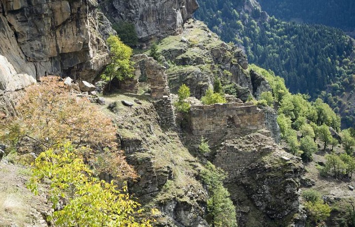
The monastery complex is located on a 150-meter horizontal ridge, partially carved into the rock and rising 80 meters above the valley. The upper part of the rock covers the monastery and makes it inaccessible. Several buildings of the complex have survived to this day. Among the most important buildings that have survived to this day are two churches, standing roughly parallel to each other and built on a specially constructed foundation, on stony gravel.

Fortress of Pharnaki (Region Tao)

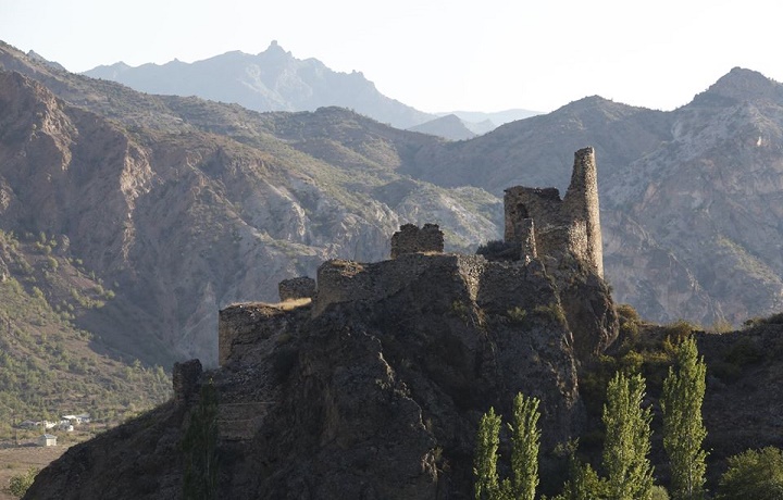
Fortress of Pharnaki (Georg. ფარნაკის ციხე, Tur. Iriağaç kalesi) – located in the Georgian historical region – Tao (Georg. ტაო), north of the historical village of Pharnaki (Georg. ფარნაკი), now Iriağaç, at the confluence of the Bana River (Georg. ბანა) and Oltisi, in the province of Erzurum (Georg. კარნუ-ქალაქი), Turkey.

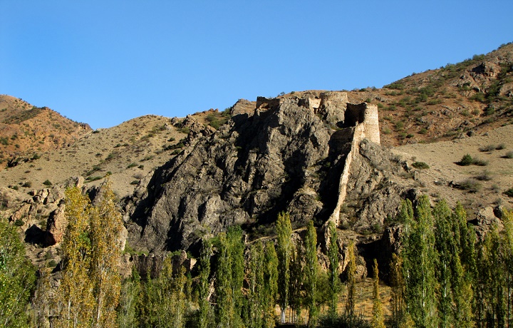
In terms of style and construction methods, it was built in the early Middle Ages. The walls of Pharnaki have a reddish tint and the Turks call it the Red Castle. The castle complex is well inscribed in the outlines of the rock. It is built on an elongated rocky hill surrounded by high whitewashed walls. Due to the difficult terrain, the castle has several levels. At the foot of the castle, in an open meadow, the ruins of a once vast palace, as well as a bathhouse with a spherical roof, have been preserved. A church was built on the edge of the cliff, one wall of which is a rock.

Parkhali Monastery (Region of Tao)

Parkhali Monastery (georg. პარხალის მონასტერი, Tur. Parchali Manastiri) – Georgian monastery in Turkey. The monastery complex is located in the historical region-Tao, in the valley of ParkhalisTskali (georg, პარხალისწყალი), the left tributary of the Chorokhi River, on the eastern slope of Mount Lazistan (georg. ლაზეთი)

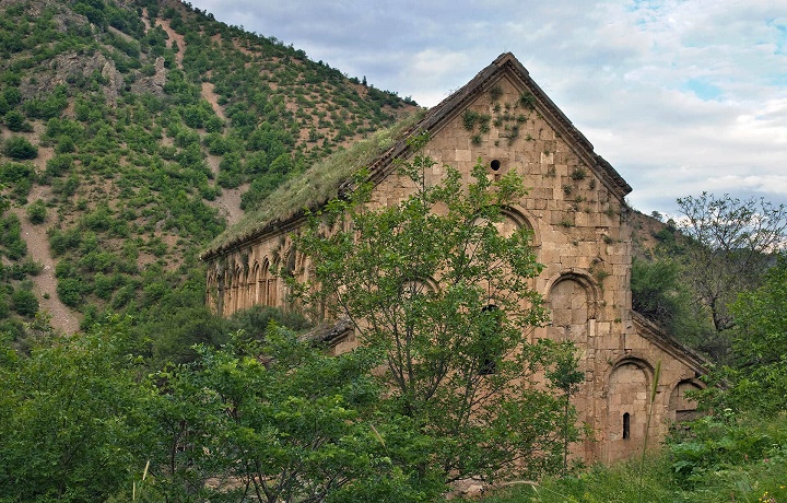
One of the masterpieces of Georgian architecture of the 10th century is covered with hewn stone slabs. Carved ornaments on the walls are made by the skillful hand of the master. Very fine ornaments, which after many centuries have remained unchanged, surprise the eye of the viewer. They say that the stones for the construction of the temple were brought from afar. Local residents turned the temple into a mosque and whitewashed the frescoes on the inner walls of the church. The outer facade of the temple has been preserved intact, as it was many centuries ago.

Church of Pekrasheni (Region of Artaani)

Church of  Pekrasheni (Georg. ფექრაშენის ეკლესია Tur. Gülyüzü kilisesi) – Georgian Orthodox basilica-plan church, built near Lake of Chrdili (modern Childir) (Georg. ჩრდილი), in the historical region of Georgia – Artaani (Georg. არტაანი), Turkey. According to the stylistic and architectural features, the church can be dated to the second half of the 10th century.

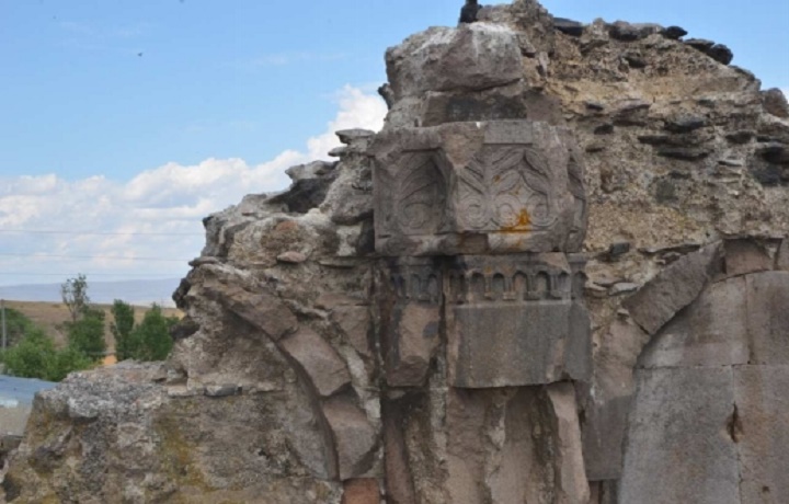
The temple is heavily damaged, but some walls and interesting details have been preserved. Stone facades and walls were decorated with arches. The capitals with beautiful floral ornaments have been preserved in the interior. The eastern wall of the temple, decorated with powerful triangular niches, is currently partially destroyed. The only surviving niche is completed by an arch in the form of a shell. Unfortunately, the remaining space of the church has been turned into a womb.

Fortress of Petereki(Agaraki) (Region of Speri)

Fortress of Petereki(Agaraki) (Georg. პეტერეკი(ფეთერექი), Tur.Peterek Kalesi), in georgian – Fortress of Agaraki (Georg. აგარაკის ციხე), is located in the historical village – Agaraki (Georg. აგარაკი), the modern Peterek, in the Georgian historical region- Speri (Georg. სპერი), the modern province of Artvin, Turkey.

The complex is located in the southern part of the village, on a cape, at an altitude of 730 meters above sea level and includes a tower, a church and the main building. The fortress was built of large and medium boulders using the dry masonry method. The plan is asymmetric. The large-scale fortress is quite well preserved. The road leading from the Petereki(Agaraki) ravine to the castle was blocked by another door. To the west of the castle, traces of an outer gate and, probably, a tower built into the rock are visible. The inner space has been completely excavated by treasure seekers.

Sakire (Sikiarebi) Church (Region of Artaani)

Sakire (Sikiarebi)  church (Georg. საკირეს (სიკიარების) ეკლესია, Tur. Iskareb Kilissi)  is located in the Georgian historical region – Artaani (Georg. არტაანი Tur. Ardakhan), in the modern village of Kotanli (Tur. Kotanli), Turkey. Previously, this place was called Sikiarebi (Georg. სიკიარები), hence the name of the Church. The church, which is largely destroyed, was built in the 10th century.

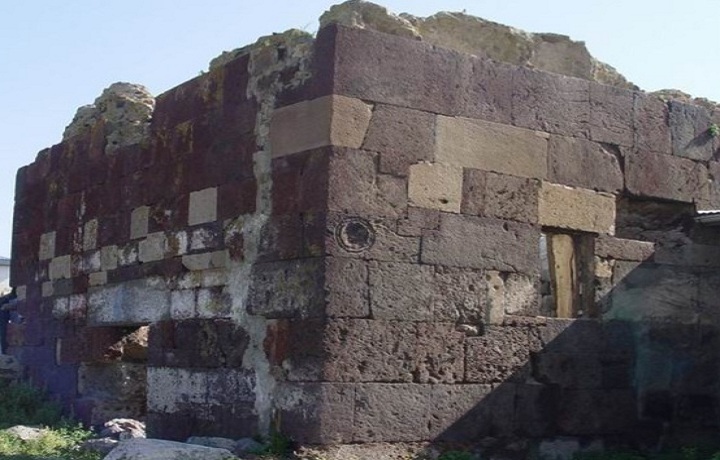
The building with one nave is an interesting architectural example. Built of reddish and gray basalt stone. The thickness of the walls exceeds 80 cm. The front stone is well smoothed and arranged in straight rows. On the eastern facade, at the top and bottom of the window, there is a Georgian inscription in letters “Asomtavruli” (Georg. ასომთავრული). From the inscriptions established by the Georgian historian Ekvtime Takaishvili, it follows that the Church of Sakire (Sikiarebi) was dedicated to St. George.

Fortress of Satle (Satleli) (Region of Shavsheti)

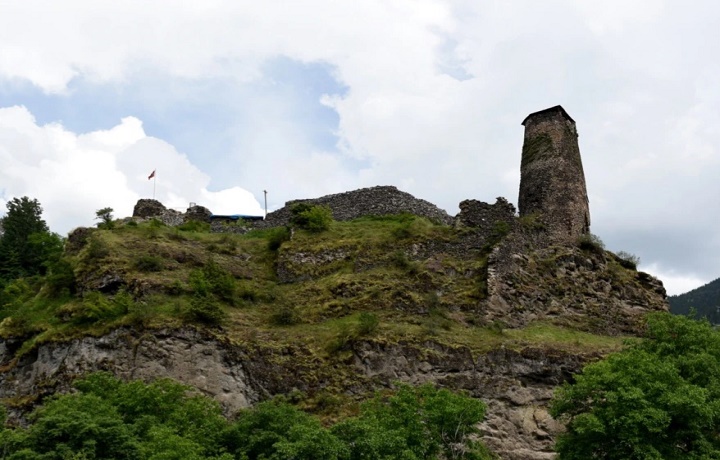
Fortress of Satle (Satleli, Shavsheti) (Georg. სათლეს (სათლელის) ციხე, Tur. Satleli(Şavşat) Kalesi). located in the ეორგიან historical region – Shavsheti (Georgian შავშეთი), in the Artvin province of modern Turkey, not far from the village – Satle (Georg. სათლე), modern Savsat (Şavşat). The castle was built by Bishop Saba Mtbevari in 1028 and occupied a rather strategic position. The construction of the castle was associated with complex relations between Georgia and Byzantium in the 10th-11th centuries. He controlled the ancient roads connecting Tao-Klarjeti.

The castle was built at the confluence of the rivers Mere (Georg.მერე) and Shavsheti (Georg. შავშეთი), on an elevated triangular rocky hill. The tallest building in the castle is the tower, 19 meters high. From here, both the Shavsheti and Mere valleys and the territory of the castle were controlled. On the inner territory of the castle, the remains of buildings for various purposes have been preserved. The castle with a unique location was the main defensive structure of the original Georgian territory of Shavsheti. During the time of David Agmashenebeli and Queen Tamara, she had a special burden.