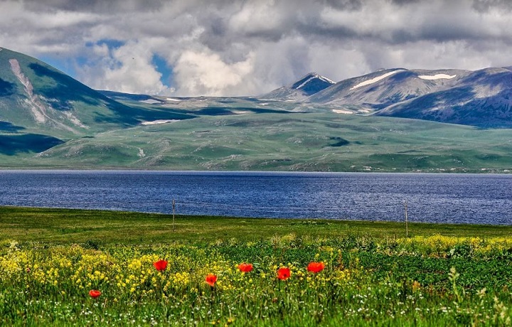
National Park of Javakheti (Eastern Georgia, Region of Samtskhe-Javakheti)
Javakheti National Park is particularly attractive. There are beautiful pastures with a variety of flora, highlands of volcanic origin and unique in their beauty lakes, including the largest in Georgia – Lake Paravani. Javakheti National Park was founded in 2011 on the basis of the Georgian legislation “On the Establishment and Management of Protected Areas of Javakheti” and includes the Javakheti National Park, Lake Bugdasheni, Sulda Swamp, Kartsakhi Swamp in Akhalkalaki Municipality and Madatapa and Khanchali Lake in Ninotsminda. The total area of these territories is 16,614 hectares.
There are practically no forests in Javakheti. Here you can find artificial pine plantations and rare fragments of natural forests. The largest natural subalpine forest, consisting of white birch, Caucasian mountain ash, dogwood bushes, rose hips and raspberries, can be found in the vicinity of Lake Kartsakh, located on the Turkish-Georgian border. The Javakheti Highlands are the coldest among the populated areas of Georgia. These places are characterized by a dry continental climate, and the average annual temperature is quite low. Javakheti lakes freeze for a long time in winter
On 7 walking, horse and cycling routes in Javakheti, from the towers specially equipped for bird watching, at different times of the year one can observe 140 species of both nesting and migratory birds. Lakes Madatafa, Khanchali and Kartsakhi are habitats for water birds. Here you can find many white storks, which nest right on electric poles and on the roofs of village houses. On the lakes Madatafa and Kartsakhi, you can observe cranes and Dalmatians. Here you can also meet huge colonies of Armenian gulls. The lakes are rich in different types of fish and are ideal for recreational fishing.
Travel company «Georgia Voyage», gives tourists the opportunity to receive all the necessary information. For more information, do not hesitate to call us or write us Viber / WhatsApp +995 599 25 65 19 or an E-mail : info@georgiavoyage.ge![]() We are always ready to advise you and answer all your questions, regarding the organization of tourism and recreation in Georgia.
We are always ready to advise you and answer all your questions, regarding the organization of tourism and recreation in Georgia.
The program of each hike is discussed and planned individually, taking into account your wishes, for a better overview of the paths and hikes on the territory of Djavakheti National Park.
Marked and organized by us trails:
1.Kartsakhi Lake -3km, 1 day, cycling / pedestrian, level of difficulty – easy
The route starts from Javakheti Protected Areas administration building and goes towards Georgia’s border with Turkey. The trail runs along the shore of Kartsakhi Lake before reaching a bird watching tower and goes back via another route. Birds can be observed from the tower, which features informational boards on local species, and visitors can make use of the picnic area with toilet facilities. The route is of particular interest to ornithologists and those who enjoy fishing.
2.Sulda swamps – 5km, 1 day, pedestrian, level of difficulty – easy
This route starts from Javakheti Protected Areas administration building and heads towards Georgia’s border with Turkey. On the way, it passes through the village of Miasnikiani and ends near the Sulda Wetlands, returning via the same route. Visitors can enjoy birdwatching, horse riding and fishing as part of a tour on this route.
3.Tiger Canyon – 15km, 1 day, pedestrian/horse riding, difficult
This route runs along the eastern range of Tiger Canyon, finishing with panoramics views. Tiger Canyon owes its name to the many vivid colors found in the surrounding landscapes, which give the canyon the appearance of being striped like a tiger. Visitors can extend the hike by climbing the nearby mountain (which peaks at 2980 meters above sea level), which leads to the meeting point between the borders of Armenia, Georgia and Turkey.
4. Khanchali lake – 3km, 1 day, cycling /pedestrian, difficulty – average
The route runs along the shore of Lake Khanchal, at an altitude of 1920 m above sea level. Many endangered birds use this lake for nesting during the breeding season or during migration. The river flows from the northwest of the lake. Agrichai flowing into the river. Paravani. Recreational fishing is allowed here.
5.Bughdasheni Lake – 2km, 1 day, pedestrian, difficulty – easy
This route runs along the shore of Bughdasheni Lake in the direction of bird watching tower, heading back via the same route. Much of the Southern part of this area consists of wetlands. The area around the lake is home for part of the year to many species of migratory birds and the shore largely pristine and undisturbed. A picnic area and the bird watching tower are available for use by visitors.
6.Madatapa Lake – 22km , 1 day, cycling trail, horse riding and pedestrian, difficulty – average
The route starts from the village of Sameba and runs along the eastern shore of Madatapa Lake. At the foot of the mountain Madatapa, there is a picnic area and a bird watching tower on an eastern promontory . A spectacular vista of the lake and the bays on its eastern shore opens from this area.
7.Madatapa Mountain – 18km, 1 day, pedestrian, difficult
Mountain Madatapa is a cone-shaped mountain of volcanic origin, from which a scenic panorama of the Javakheti Plateau and the Samsari Range opens up. At the top of the mountain, the remains of a circular megalithic construction can be found.


