Doliskana Monastery (Region of Klarjeti)

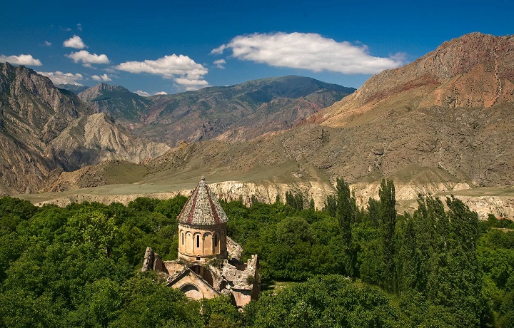
The monastery of Doliskan (Georg. დოლისყანის მონასტერი, Tur. Doliskana manastırı) – the Georgian Monastery in the historical region of Georgia – Klarjeti (Georg. კლარჯეთი). It is located in the historical village of Doliskana (Georg. დოლისყანა), now Hamamli (Tur. Hamamli), on the territory of modern Turkey. The name Doliskana in Georgian means wheat field (Georg. დოლის პურის ყანა). There is a legend that the Georgian king donated wheat fields to the monastery, hence its name. The main church is the only surviving building of the monastery, which is due to the fact that until recently there was a Muslim Mosque here. There are two different views on whether the church was dedicated to the holy Archangels or to St. Stephen. The murals of the temple of the XI-XIII centuries are almost completely destroyed. It should be noted that in addition to Georgian inscriptions, one fresco of the church has an Arabic inscriptionone – a very rare occurrence in the Georgian church tradition.

There is no exact information about the date of foundation of the monastery complex. Doliskana was not yet a monastery when the locals visited the church as a place of worship for God. According to building inscriptions placed on the facade, the church was built in the X century, which is confirmed by the stylistic analysis of the monument. According to one part of the researchers. the temple was built earlier, and later only rebuilt. It is possible that the foundation of the church was laid in the first half of the X century, and in the second half of the same century it was only rebuilt and turned into a monastic ensemble. The architecture of the church indicates that it was built during the heyday of the art of architecture in Tao-Klarjeti. The architectural elements of a new era appear in it. The facade of the Church is distinguished by the abundance and variety of sculptural reliefs and is covered with stones of different colors. On one of the large stones of the southern facade, a sundial is carved, which was used by the local population until the end of the XX century and which disappeared in 2003, under suspicious circumstances. It should be noted that due to the soil brought during the rains, the initial ground level of the monastery complex increased by 3-4 meters.

Esbeki Fortress (Region of Tao)

Esbeki Fortress (Georg. ესბეკის(ესბექის) ციხე, Tur. Esbek Kalesi) is located in the historical region of Georgia – Tao (Georg. ტაო), not far from the historical village of Esbeki, now Darija (Tur.Darica), on the left bank of the river Oltisi (Georg. ოლთისი). The fortress was built on a steep rock overlooking the surrounding area, to the east of the Esbeki complex (Georg. ესბეკის კომპლექსი). Judging by the design features of the fortress, and due to its similarity with the castles of the royal dynasty of Bagrationi (Georg. ბაგრატიონი), which is found in this region, we can say that it was built in the 9th century. The foundation and individual fragments of the protective wall have survived to this day, the height of which in some places reaches 3-4 meters. The entrance gate is located in the southern part of the wall. In the eastern part of the castle there is a square bastion, and to the east of the entrance, a rectangular space attached to the walls, fenced on three sides.

From an architectural point of view, the Esbeki complex is one of the interesting examples of architectural buildings of the early period of Tao-Klarjeti (Georg. ტაო-კლარჯეთი). The fortress and the complex adjacent to it from the south occupied a strategically important position. Spread over a large paved area, the complex consists of two chronological layers. It consists of: a three-nave basilica, which occupies one of the prominent places among churches of this type due to a number of features of the general architectural and compositional solution, two hall churches built of stone and brick and the remains of a two-tiered chapel-tomb, with jagged window openings in the walls . A few meters from the above-mentioned buildings there is another small stone hall church. Other buildings of the Esbek complex include fortress walls of different periods in the north and west, a watchtower and a single-nave chapel.

Ishkhani Cathedral (Region of Tao)

Ishkhani Cathedral (Georg. იშხანის ტაძარი, Tur. İşhan Manastır Kilisesi), is located in the historical region of Georgia – Tao (Georg. ტაო), the Artvin vilayet of modern Turkey, in the village of Arpacik (Tur. Arpacik). The first church on the site of today’s church, was built by the Armenian Catholicos Nerses in 647, which was destroyed as a result of the Arab campaigns of 736-738. From the construction of that time, only the sanctuary remains. In the 9th century (836), the temple, razed to the ground, was first restored by the Bishop of Ishkhani – Saba Ishkhneli (Georg. საბა იშხნელი). A small part of the remains of two old versions, in the second half of the 10th century, was included in the building of the great cathedral, built by the architect – Ioane Morchaisdze. According to historical sources, on the orders of the master, for the construction of the temple, the workers poured lime with milk. Because of this, the church acquired more beauty and strength.

The restored and decorated church of Ishkhani,  has been one of the most important episcopal cathedrals of Southern Georgia for centuries and  an achievement of Georgian architecture. This is one of the largest buildings among the Georgian domed architectural structures, the style of which reflects the various stages of development of the architecture and building culture of Georgia. The frescoes and inscriptions of the Ishkhni Cathedral keep important facts of Georgian history. Here ancient Georgian manuscripts were created and kept for centuries. Unfortunately, most of the written monuments preserved in the library have not survived to this day. The episcopal see in Ishkhani existed until the second half of the 17th century. Later it was turned into a mosque. For a long time, the unique monument stood in ruins. In 2013, after repeated attempts by Georgia, Turkish restorers restored the temple.

Jaki Fortress (Region of Potskhovi)

Jaki Fortress (Georg. ჯაყის ციხე Tour. Caki Kalesi) is located in the historical region of Georgia – Potskhovi (Georg. ფოცხოვი), within the boundaries of the village of Chambeli (Tur. Çambeli), the Posof district of modern Turkey. The medieval castle was the residence of large feudal lords – Jakeli (Georg.  ჯაყელი) and the administrative center of the region. The fortress was built on a high ridge of a river valley, on the left bank of the Jakistskali River (Georg. ჯაყისწყალი) and for several centuries, had an important military significance.

The castle is surrounded by a river on three sides and, due to natural conditions, is quite well protected. Right at the top of the ridge, two watchtowers have been preserved. The height of the walls of the protective fence of the castle in some places reaches 10 meters, on which traces of destruction and restoration are visible in different periods. Its early building layers used relatively well-worked, medium-sized stone. To strengthen the walls, rectangular buttresses were built in several places. The only entrance to the castle was located in the center of the southern wall.

Jakisubani (Jakismani) monastery (Region of Potskhovi)

The monastery complex of Jakisubani (Jakismani) (Georg. ჯაყისუბნის (ჯაყისმანის) მონასტერი, Tur. Jakismani manastiri) is located in the historical region of Georgia – Samskhe (Georg. ფოცხოვი), in modern Turkey. Not much is known about the history of this unique structure. There is no information about the exact dates of construction. In terms of building style, the monument is a model of Georgian architecture of the 10th-11th centuries. The conditional name Jaksisubani (Jakismani) most likely comes from the ancient Georgian toponym of this area, historically called Jaki (Georg. ჯაყი).

The monastery complex is located on the territory of an old Georgian village, on an artificially leveled site overlooking the valley of the Potskhovistskali River (Georg.  ფოცხოვისწყალი). The complex consists of the main temple of the hall type and two small chapels. The monastery complex Dzhakisubani (Dzhakismani) is one of the remarkable monuments of Georgian architecture. The high level of technology in the construction of the main temple, the proportional arrangement of the walls, skillfully crafted paving stones and graceful vaults deserve special attention. It can be said that the church, in terms of its artistic value, is one of the outstanding churches of the Samtskhe-Javakheti region (Georg. სამცხე-ჯავახეთი).

Jijori Church (Region of  Kola)

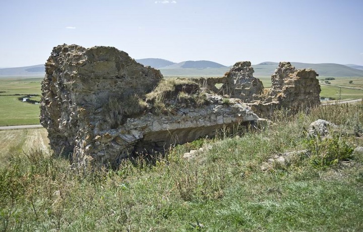
Jijori Church (Georg. ჯიჯორის ეკლესია, Tur. Cicori Kilisesi) – Georgian temple in the historical region of Georgia – Kola (Georg. კოლა), on the territory of modern Turkey. Located in the village of Budakli (Tur. Budaklı), formerly known as Jijori (Georg. ჯიჯორი). The church was built in the 10th century and is a hall structure. This is a single-nave building measuring approximately 11 x 4 m, built of roughly hewn small stones.

The surviving part of the walls is now presented in the form of ruins. A Georgian researcher who visited the village of Dzhidzhori at the beginning of the 20th century spoke about a completely intact church with Georgian inscriptions. The church was destroyed in 1907. The central parts on the southern and eastern walls were demolished, the arches and vaults were destroyed, and the lining was looted. On the north side, a two-story building was attached to the temple, which was largely destroyed.


Jmerki Monastery (Region of  Klarjeti)

Jmerki Monastery (Georg. ჯმერკის მონასტერი, Tur. Cmerki Manastırı) –  Georgian medieval monastery of the Assumption of the Mother of God, located in the Georgian historical region – Klarjeti (Georg. კლარჯეთი), on the territory of modern Turkey, the province of Artvin (Georg. ართვინი), near the Georgian historical village – Jmerki (Georg. ჯმერკი), modern Chimenli (Tur. Çımenli) The monastery was founded in the 9th century and is mentioned among the twelve monasteries (deserts) of Klarjeti. The monastery is located on a steep slope near the current village of Chimenli. Four terraces for monastic buildings were arranged here, one above the other. There was a church on the upper terrace, and some large building, probably a refectory, on the next terrace. There was nothing left on the two lower terraces.

The church, which was a small rectangular building, towered on retaining walls made of rubble stones. While the western wall of the church was completely destroyed, the rest of the facade walls remained virtually intact. Due to the destruction, the door and window openings of the church cannot be identified. Therefore, it is not possible to accurately determine the architectural style of the church. The church dedicated to the Blessed Virgin Mary is a three-aisled basilica or a domed structure with a closed transverse plan. The roof and internal walls of the church are also completely destroyed. The monastery continued its activity in the early and late Middle Ages. In 1080, the Jmerki monastery and other religious buildings in the region were looted and burned by the Seljuks, who captured the Tao-Klarjeti region. It is believed that religious activity in the monastery did not resume after this date.

Fortress of Kaji (Region of Erusheti)

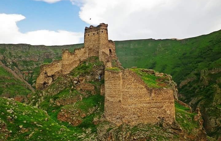
Fortress of Kaji (Georg. ქაჯის ციხე, Tur. Şeytan Kalesi) is located in the historical region of Georgia – Erusheti (Georg. ერუშეთი), on a rocky hill in a remote canyon of the Mtkvari River (Georg. მტკვარი), north of the modern village of Yildirimtepe (Turk. Yıldırımtepe), in the Turkish province Ardahan (Georg. არტაანი). It is possible to access this hill, which breaks off on three sides, only from one side. The castle, towering 1910 meters above sea level, has survived to this day in a very strong condition. Large sections of the wall and the entrance gate are still standing. The dimensions of the Fortress, which has an asymmetrical plan, are 161 × 93 m. Of the existing 3 towers, one survived. Inside the walls, the remains of the reservoir, the chapel and the church of St. Stephen the First Martyr have been preserved.

The current Fortress dates back to the 13th century when Georgian kings ruled the area. It probably served as a border fortress. It is believed that the castle is called the –“Devil’s Castle” due to its complex location and difficulty in capturing. It is assumed that it is the Kaji Fortress that is the prototype of the impregnable fortress – “Kajeti” (Georg. ქაჯეთი), in Shota Rustaveli’s poem – “The Knight in the Panther’s Skin” (Georg. ვეფხისტყაოსანი). Throughout its history, Kaji Fortress has been in the territory ruled by the Persians, Macedonians, Romans, Georgians and Ottomans. All these rulers probably used the castle and adapted it to their wishes. The Fortress suffered from illegal treasure hunting due to the legend that somewhere inside the castle the daughter of a Georgian king was buried along with gold and other treasures.

Forteress of Kalmakhi (Region of Tao)

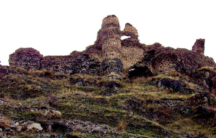
Kalmakhi (Solomonisi) Fortress (Georg. კალმახის (სოლომონისის) ციხე, Tur. Kamhis Kalesi). The fortress is located in the historical region of Georgia – Tao (Georg. ტაო), south of the historical Georgian village of Solomonisi (Georg. სოლომონისი), now Evbakan(Tur. Evbakan), On the territory of modern Turkey.  The castle, which was the residence of Georgian kings and nobility, was built in the 8th century and has been the administrative center of the historic district for centuries. In addition to administrative and defensive functions, educational activities were carried out here, and the Gospel, which was copied in this castle in 1520, has survived to this day.

Kalmakhi Fortress is built on top of a mountain. On the northern side, a 30-meter part of the protective wall with two round towers in the middle has been preserved. The foundation of the third tower stands out in the northeast corner. The wall is built of rough stone. The interior of the castle consisted of two defensive zones. The south side was less well defended due to the collapsed rock. The gate was supposed to be between the two middle towers. The domed church in the fortress described in written sources was destroyed.

Fortress of Kavkasidze (Region of Tao)

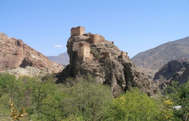
Kavkasidze Fortress (Georg. კავკასიძეების ციხე, Tur. Tek kale) is located in the historical region of Georgia – Tao (Georg. ტაო). The historical name and the exact date of construction are unknown. Since the walls of the castle are built of rubble, which is comparable to other medieval castles in the region, it is believed that it was built in the Middle Ages. Currently, it is called Kavkazdze  fortress by the name of its former owners. Historical sources mention the builder and owner of the fortress – Murvan Kavkasidze. It is sometimes called the fortress of the Four Churches (Georg. ოთხთა ეკლესიის ციხე).

It is located on a large and steep rock in the middle of the Chorokhi valley (Georg. ჭოროხი), on the road connecting the historical regions of Georgia – Speri (Georg. სპერი ) and Tao. The castle is an elongated complex with a complex layout. The original entrance was probably on the west side of the rock. A couple of towers have been preserved on the western and southern parts of the cliff top. The fortress was protected by a wall of different heights and complexity along the entire perimeter, which was due to both the terrain and the orientation to the road coming from the south. The most fortified part was the southern and western side, from where the castle was protected by additional walls and supports. A reservoir, a stone wall and a small hall church have been preserved on the territory.